


Beschreibung
Die Navionics+ 643L – Mittelmeer & Schwarzes Meer (Large) bietet eine detaillierte Seekartografie für das gesamte Mittelmeer sowie das Schwarze Meer.
Sie enthält präzise Informationen zu Wassertiefen, Tiefenkonturen, Seezeichen, Häfen, Fahrwassern und navigierbaren Zonen für eine sichere und zuverlässige Navigation.
Die übersichtliche Darstellung unterstützt sowohl Küsten- als auch Hochseefahrt.
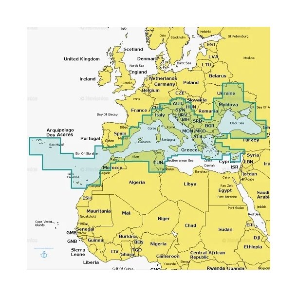
Abdeckungsgebiet
Die Karte umfasst unter anderem:
-
Westliches und östliches Mittelmeer
-
Küsten von Spanien, Frankreich, Italien und Griechenland
-
Adria
-
Ägäis
-
Schwarzes Meer
-
Wichtige Küsten- und Hafenregionen
Erweiterte Kartografie & SonarChart™
Mit SonarChart™ erhalten Sie eine hochauflösende bathymetrische Darstellung mit detaillierten Informationen zu Unterwasserstrukturen – ideal für präzise Navigation und Angeln.
Dock-to-Dock Autorouting™
Die Funktion Dock-to-Dock Autorouting™ ermöglicht die automatische Routenplanung von Hafen zu Hafen auf Basis verfügbarer Kartendaten wie Tiefen, Fahrwasser und Seezeichen.
Die berechnete Route dient als Navigationshilfe und muss stets vom Skipper überprüft werden.
Kompatibilität
Kompatibel mit zahlreichen Kartenplottern, darunter Raymarine, Lowrance, Humminbird, Furuno, Eagle und weitere unterstützte Marken.
Bitte geben Sie bei der Bestellung Hersteller und Modell Ihres Plotters an.
Aktivierung & Updates
Die Karte wird zum Bestelldatum aktiviert und beinhaltet 12 Monate Karten-Updates ab Aktivierungsdatum.
Fragen zum Product ?
Füll das folgende Formular aus, und wir werden uns so schnell wie möglich bei dir zurückmelden


